

West Slopes Central
Backcountry Avalanche Forecast
Author: Lee Lazzara
Issued: Sunday, March 15, 2026 at 6:30 PM PDT
Expires: Monday, March 16, 2026 at 6:30 PM PDT
The Bottom Line
 The Bottom Line
Heavy rainfall will create very dangerous avalanche conditions as dry snow turns wet and unstable. Avoid traveling anywhere in the mountains where avalanches can start, run, or stop. Danger may be lower in the north half of West Central, where there should be less dry snow on the ground and less rainfall in the forecast, but wet snow avalanches are still likely.
Avalanche Danger
Monday, March 16, 2026
7500-5500ft4 - High

5500-4500ft4 - High
4500-2500ft3 - Considerable

Tuesday, March 17, 2026
7500-5500ft3 - Considerable
5500-4500ft3 - Considerable
4500-2500ft3 - Considerable
Avalanche Danger ScaleLearn moreGeneral InfoGeneral Information1 - LowLow2 - ModModerate3 - ConsConsiderable4 - HighHigh5 - ExtrExtreme
 1 - Low |  2 - Moderate | 3 - Considerable | 4 - High |  5 - Extreme | |
|---|---|---|---|---|---|
| Travel Advice | Generally safe avalanche conditions. Watch for unstable snow on isolated terrain features. | Heightened avalanche conditions on specific terrain features. Evaluate snow and terrain carefully; identify features of concern. | Dangerous avalanche conditions. Careful snowpack evaluation, cautious route-finding and conservative decision-making essential. | Very dangerous avalanche conditions. Travel in avalanche terrain not recommended. | Extraordinarily dangerous avalanche conditions. Avoid all avalanche terrain. |
| Likelihood of Avalanches | Natural and human-triggered avalanches unlikely. | Natural avalanches unlikely; human-triggered avalanches possible. | Natural avalanches possible; human-triggered avalanches likely. | Natural avalanches likely; human-triggered avalanches very likely. | Natural and human-triggered avalanches certain. |
| Avalanche Size and Distribution | Small avalanches in isolated areas or extreme terrain. | Small avalanches in specific areas; or large avalanches in isolated areas. | Small avalanches in many areas; or large avalanches in specific areas; or very large avalanches in isolated areas. | Large avalanches in many areas; or very large avalanches in specific areas. | Very large avalanches in many areas. |
Avalanche Problems (1)
Problem #1: Wet Slab
Problem Type
Wet Slab
Aspect/Elevation
Likelihood
Size
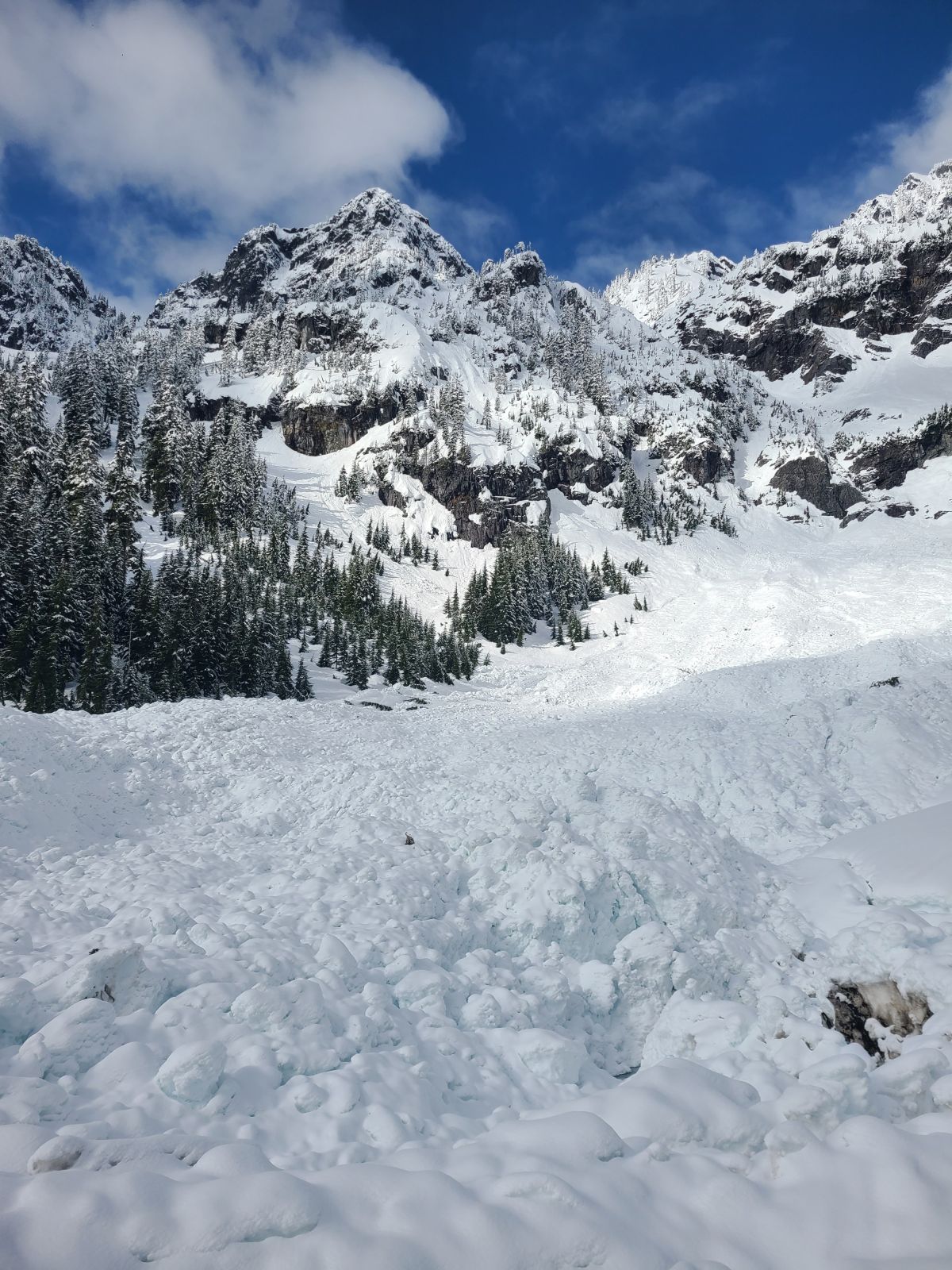
(4/3/2025)
Large wet avalanches produce thick, nasty debris. You don't want to get caught in this.
Photo: Katie Warren
Rain on dry snow is never a good time—unless you’re a fan of wet avalanches. Heavy rainfall on a dry, layered snowpack can produce all varieties of wet avalanches, including slab, loose, glide, and cornice fall.
The best policy will be to eliminate exposure to avalanche terrain where the snow is mushy and the precipitation is wet, not white. This includes corniced ridgelines and snow-covered cliffs. Avoiding steep slopes is obvious travel advice, but also be aware of big terrain above you. Wet natural avalanches can run surprisingly far or step down into deeper layers and produce a very large, dangerous avalanche.
Forecast Discussion
West Central didn’t produce much in the way of direct observations on Sunday, but nearby zones give us a pretty good idea of what’s going on. In West North, a quiet morning turned blustery as winds picked up and began drifting snow. Observers reported plenty of wind transport and fresh slabs, though most were shallow and small. Settlement seemed to keep loose dry avalanches in check.
Conditions at Stevens Pass and along Highway 2 (Stevens/Highway corridor) have been much more concerning. Professionals at Stevens Pass Ski Area and WSDOT have triggered very large avalanches over the past several days, including size D2.5–3 slides on the 13th and 14th. Even late in the week, observers reported unusually reactive conditions with avalanches breaking wide, running long distances, and occasionally propagating onto lower-angle terrain.
Snowpack information from Snoqualmie Pass (SNQ) shows two notable crust layers within last week’s storm snow: a crust from 3/12 about three feet below the surface, and the 3/8 crust roughly a foot below that at the base of the storm snow. The main question for Monday is whether rain and warming will send water deep enough to reach these layers. If it does, much larger and more destructive avalanches could quickly become possible.
This information is provided by the U.S.D.A. Forest Service and describes general backcountry avalanche hazard and conditions.
It does not apply to ski areas and highways where avalanche mitigation is conducted.