

West Slopes Central
Backcountry Avalanche Forecast
Author: Lee Lazzara
Issued: Saturday, March 14, 2026 at 6:30 PM PDT
Expires: Sunday, March 15, 2026 at 6:30 PM PDT
The Bottom Line
 The Bottom Line
There is plenty of new snow out there. The likelihood of triggering an avalanche is decreasing, but stay on guard if you’re considering steep slopes. Assess stability before committing to terrain steep enough to slide. When in doubt, default to lower-angle, simpler terrain.
Avalanche Danger
Sunday, March 15, 2026
7500-5500ft3 - Considerable

5500-4500ft3 - Considerable
4500-2500ft2 - Moderate

Monday, March 16, 2026
7500-5500ft4 - High

5500-4500ft3 - Considerable
4500-2500ft3 - Considerable
Avalanche Danger ScaleLearn moreGeneral InfoGeneral Information1 - LowLow2 - ModModerate3 - ConsConsiderable4 - HighHigh5 - ExtrExtreme
 1 - Low | 2 - Moderate | 3 - Considerable | 4 - High |  5 - Extreme | |
|---|---|---|---|---|---|
| Travel Advice | Generally safe avalanche conditions. Watch for unstable snow on isolated terrain features. | Heightened avalanche conditions on specific terrain features. Evaluate snow and terrain carefully; identify features of concern. | Dangerous avalanche conditions. Careful snowpack evaluation, cautious route-finding and conservative decision-making essential. | Very dangerous avalanche conditions. Travel in avalanche terrain not recommended. | Extraordinarily dangerous avalanche conditions. Avoid all avalanche terrain. |
| Likelihood of Avalanches | Natural and human-triggered avalanches unlikely. | Natural avalanches unlikely; human-triggered avalanches possible. | Natural avalanches possible; human-triggered avalanches likely. | Natural avalanches likely; human-triggered avalanches very likely. | Natural and human-triggered avalanches certain. |
| Avalanche Size and Distribution | Small avalanches in isolated areas or extreme terrain. | Small avalanches in specific areas; or large avalanches in isolated areas. | Small avalanches in many areas; or large avalanches in specific areas; or very large avalanches in isolated areas. | Large avalanches in many areas; or very large avalanches in specific areas. | Very large avalanches in many areas. |
Avalanche Problems (1)
Problem #1: Storm Slab
Problem Type
Storm Slab
Aspect/Elevation
Likelihood
Size
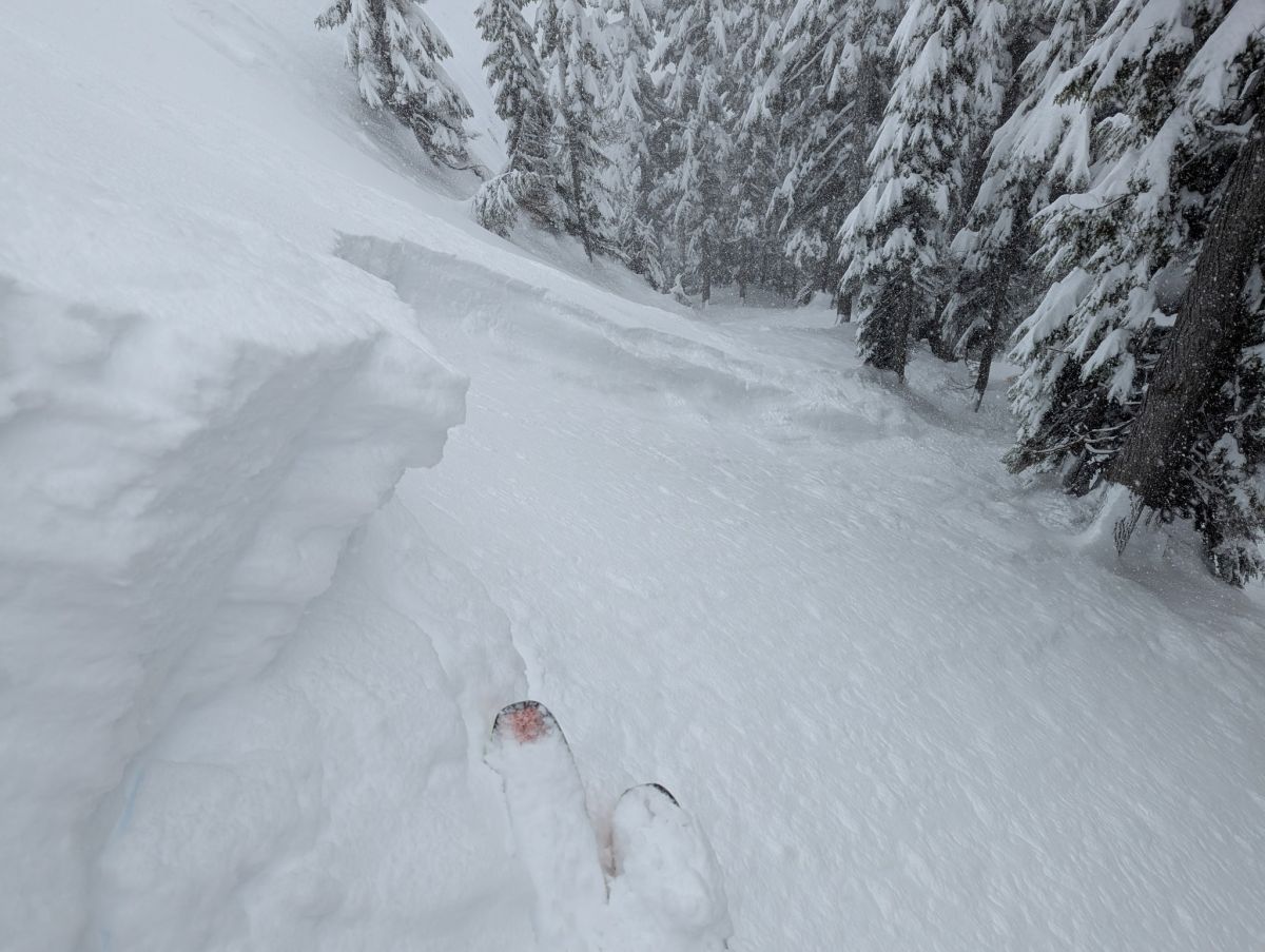
Many storm slabs released on or near the 3/12 crust on Friday.
Photo: Summit at Snoqualmie Pro PatrolFriday night brought more snow to usher in the weekend across the southern portion of the West Central forecast zone. Along with Stevens and Snoqualmie Pass, the area from the Mountain Loop Highway south to I-90 has seen 3 feet of snowfall with some areas getting as much as 5 feet.
The best gauge for terrain selection will be how much new snow you find. Deep? Stick to simpler, lower-angled terrain. If amounts are more modest, assess stability using the usual tools: slope tests and other simple methods to determine how well the new snow layers are bonding. While all steep slopes have the potential to produce avalanches, convex rollovers, unsupported terrain around cliffs and rocks, and slopes below cornices are where the likelihood of triggering a slab is greater.
Wind speeds should increase Sunday afternoon ahead of the next storm, especially at upper elevations. Look for fresh wind slabs on leeward slopes. Drifting snow will be the main sign of active transport. Monitor snow depth and stiffness as you gain elevation and change aspects. You are much more likely to trigger an avalanche on slopes with recent wind loading.
Forecast Discussion
Loose dry avalanches are still a concern where the uppermost layer of snow is loose and unconsolidated. Expect to push some snow downhill with you as you descend or traverse steep slopes. Natural loose dry avalanches are also possible below cliffs and other very steep features. These sluffs are unlikely to bury you, but they could push you around or carry you somewhere you don’t want to go. If temperatures warm more or faster than expected, you could start seeing early signs of wet avalanche activity like rollerballs, snow shedding from trees, or very small loose snow avalanches.
It was another day of varying conditions around the Cascades, with interesting activity just about everywhere. Stevens Pass remained closed, so no information has come from that zone other than reports that highway avalanche control work produced large slides that reached Highway 2—a prime example of why WSDOT crews perform avalanche control above certain roads.
A combination of loose snow and slab avalanches was reported from West North, with a few people caught and carried in both types; no injuries were reported. Despite these incidents, backcountry traffic in steep terrain was widespread, showing that while most slopes are currently stable, instability remains in select locations.
This information is provided by the U.S.D.A. Forest Service and describes general backcountry avalanche hazard and conditions.
It does not apply to ski areas and highways where avalanche mitigation is conducted.